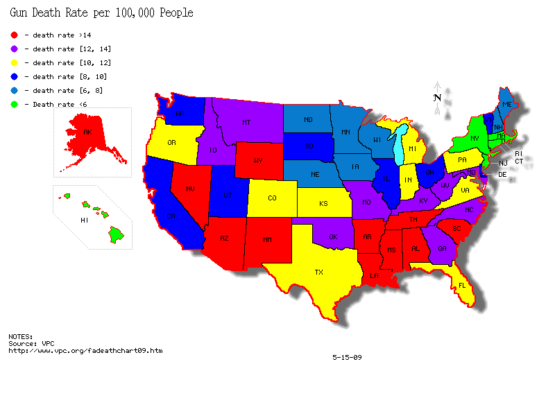
Classed Choropleth Maps use specifically delineated scales to show the occurance of a variable on the map. This means that numbers which are not equal may appear with the same color depending on whether or not they fall within the same “class” or range on the scale, as seen on the map of gun-related death rates in the USA
http://gunlawforum.files.wordpress.com/2009/05/gun_death_states1.gif
No comments:
Post a Comment