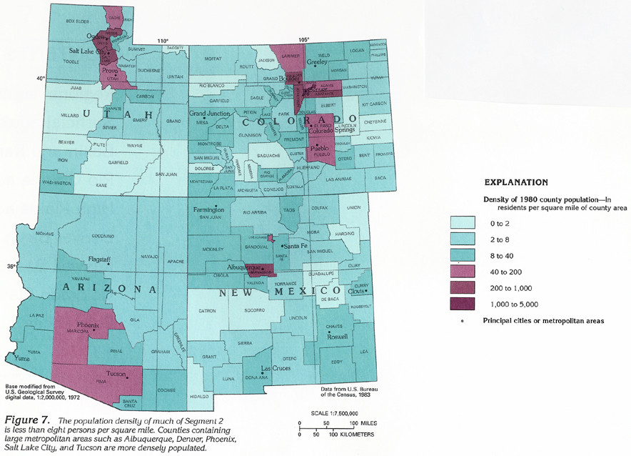
Standardized Choropleth Maps use data that have been averaged or otherwise manipulated so that one is no longer dealing with the raw numbers. Population per square mile by county, for example, shows how theses numbers don no account for county size of other factors.
http://pubs.usgs.gov/ha/ha730/ch_c/jpeg/C007.jpeg
No comments:
Post a Comment